
Access Data & Samples
 IODP data and samples are typically protected by a 1-year postcruise moratorium, during which time data and samples from a particular expedition are available only to that expedition’s science party and approved shore-based participants. If you are not a member of the science party for recent expeditions, please check the moratorium end dates.
Request Samples
Sample materials collected during IODP, ODP, and DSDP expeditions are available to researchers from any nation or research institution. Scientific merit is the primary criterion for consideration of sample materials requests; materials may also be loaned for educational or outreach purposes.
Sample requests for all DSDP, ODP, and IODP cores are submitted using the Sample and Data Requests Database (SaDR). Please review the IODP Sample, Data, and Obligations Policy before requesting samples.
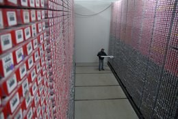
The IODP oversees 3 main core repositories around the world:
- The Bremen Core Repository (BCR) is located at the University of Bremen, Bremen, Germany. The repository houses cores collected from the Atlantic and Arctic Oceans (north of the Bering Strait).
- The Gulf Coast Repository (GCR) is located at Texas A&M University, College Station, Texas, USA. The repository houses cores from the Pacific Ocean (Pacific plate east of western boundary), the Caribbean Sea and Gulf of Mexico, and the Southern Ocean (south of 60° except Kerguelen Plateau).
- The Kochi Core Center (KCC) is located at Kochi University, Kochi, Japan. The repository houses cores from the Pacific Ocean (west of western boundary of Pacific plate), the Indian Ocean (north of 60°), all of Kerguelen Plateau, and the Bering Sea.

Microbiology Sample Material Availability
One of the scientific goals of IODP is to research the deep biosphere and the subseafloor ocean. IODP has microbiological samples from the subseafloor available for interested researchers and will continue to collect and preserve geomicrobiology samples for future research.
Lists of available microbiological samples housed at: Bremen Core Repository, Gulf Coast Repository, and Kochi Core Center.
Data Access
Databases
- JOIDES Resolution expeditions: LIMS/Janus Database
- Chikyu expeditions: SIO7 Data Centre
- Mission-specific platform expeditions: Pangaea Data Publisher
Downhole Logging Data
Logging data collected in DSDP, ODP, and in IODP by the USIO, ESO and CDEX are available through an online database managed by Lamont-Doherty Earth Observatory. All logging data collected by these programs are available online, along with information about how they were collected and processed. Several web services are also available for pulling logging data into automated tools.
Scientific Earth Drilling Information System (SEDIS)
SEDIS is a web-based information service to facilitate access to all data, publications, metadata, and information related to over 40 years of scientific ocean drilling (from the DSDP, ODP, and IODP) regardless of origin or location of data.
The three main data contributors to SEDIS currently are the IODP implementing organizations (IOs) from the United States (USIO), Japan (CDEX) and Europe with Canada (ESO). Each IO uses its own drilling platform and its internal data management systems. SEDIS serves as a portal for searching the more than 100,000 distributed IODP/ODP/DSDP data sets by utilizing standards-compliant metadata harvested via open-acess protocols.
Site Survey Data Bank (SSDB)
SSDB is a repository for digital site survey data submitted in support of IODP proposals, expeditions and related activities. Many files are freely available, but proprietary holds requested by proponents are strictly maintained. The SSDB also contains older site survey data for some ODP proposals and legs. Analog site survey data (e.g., paper plots) submitted in support of IODP, ODP and DSDP proposals and expeditions/legs are stored on site at the SSDB.
Google Earth Borehole Map
Several KML files are maintained to display drilled, scheduled and proposed IODP sites on Google Earth.
- Download and install Google Earth onto your computer.
- Download your desired KML from the IODP website.
- The Drilled Holes file shows the location of all holes drilled during DSDP, ODP, and IODP, and provides links to the related expedition publications.
- The Scheduled Expeditions file shows the location of all sites for planned expeditions, taken from the Scientific Prospectus if possible.
- The Proposed Sites file shows the location of all sites in active proposals currently under review or awaiting scheduling by Facility Boards.
- Once download is complete, open the KML with Google Earth.