Various regions of New Brunswick and Nova Scotia are at risk from saltwater and freshwater flooding, and that risk is increasing with sea level rise resulting from climate change. An extensive system of dykes, roads, railway and other flood prevention infrastructure protect thousands of hectares of valuable farmland, public roads, utilities, businesses, residences and other buildings. The province also has several dams used for hydroelectric generation. A significant flood caused by a failure in any of these systems could generate serious and long-lasting economic costs, environmental impacts and social change. Many of the earthen flood barriers are centuries old and have been repeatedly repaired or altered, meaning detailed information on their current structure and integrity is missing. Concrete dam infrastructure also poses monitoring challenges because installing modern in situ monitoring instrumentation after construction can be infeasible or impossible, or at least requires accurate information about the structures involved. The state-of-the-art geophysical imaging technology that I study and develop in my research can effectively map the underground to monitor the integrity of flood barriers and help mitigate flood risk.
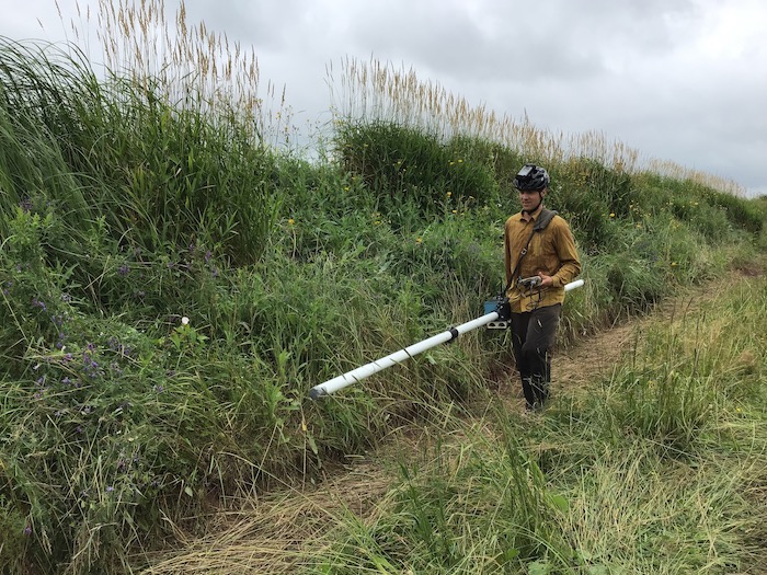
Me collecting EM31 data on a dyke in Onslow, NS. This is one type of geophysical surveying that can provide information about conductivities inside the dyke, and conductivity tells us about saltwater seepage. This dyke is scheduled to be breached for the purposes of flood management and habitat restoration, and we are using this site to help calibrate our methods. Thank you to Dr. Karl Butler at UNB for the loan of the EM31.
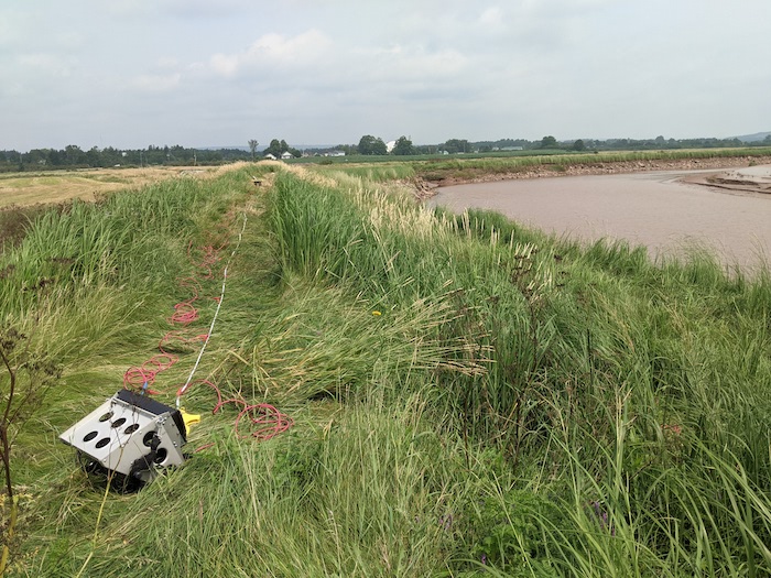
Electrical resistivity surveying on that same section of dyke in Onslow, NS. This is a second type of geophysical surveying that can provide information about conductivities and saltwater seepage. Thank you to Dr. Karl Butler at UNB for his help collecting this data.
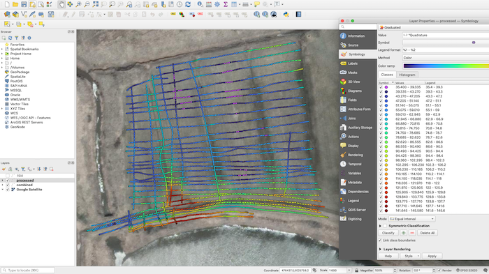
A plot of aparent conductivities obtained from EM31 data collected in a field in Onslow, NS. High conductivities (red) correspond well with locations of known or likely saltwater seepage.